When FEMA announced new funding for flood projects in the Chicago area, it created a wave of excitement among engineers, contractors, and local governments. Berwyn, Cicero, La Grange, and parts of Chicago are set to benefit from major stormwater improvements. These projects could protect thousands of homes and businesses from future flood damage. But here’s the catch: none of this work can move forward without a topo survey.
A topo survey may sound like just another technical step in the process, but in reality, it’s the foundation that makes or breaks a project. Without it, designers don’t know how the land actually behaves when heavy rain falls. And in a city like Chicago, where even a tenth of a foot in elevation can change how detention ponds or sewer systems perform, the details matter.
Why FEMA Projects Need More Than a Basic Map
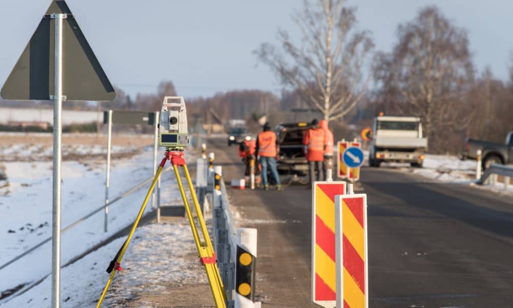
FEMA funding isn’t for guesswork. Every dollar must be justified with accurate design and solid engineering. That starts with knowing the land. A topo survey provides a detailed snapshot of the site: the highs, the lows, the slopes, and all the man-made features that influence water flow.
Think about alley crowns in Berwyn, sidewalk cross-slopes in Cicero, or basement walk-outs in older Chicago neighborhoods. Miss those details, and the proposed drainage plan may fail the first time the city reviewer checks it. Worse, the project could stall before it even reaches FEMA’s desk.
Local reviewers don’t just want to see a map. They want to see every potential low spot where water could pool, every curb and gutter that channels runoff, and every utility casting that ties into storm sewers. A topo survey delivers that clarity. Without it, even the best funding in the world can’t produce results.
Chicago’s Rules Raise the Bar

Chicago isn’t an easy city to design in, especially when it comes to stormwater. The Metropolitan Water Reclamation District (MWRD) enforces the Watershed Management Ordinance (WMO), which sets the standard for grading, detention, and flood control. On top of that, the city has updated its rainfall data from Bulletin 70 to Bulletin 75.
What does that mean for a developer or contractor? It means storms are modeled as heavier and more intense than before. More rainfall equals larger detention volumes, stricter grading, and less room for error.
If an engineer submits a plan that shows detention volume short by even a few cubic feet, it gets kicked back. And often, that rejection comes down to the topo data. If the survey shows a site elevation off by 0.10 feet, it can change the math enough to derail the permit. That’s why topo surveys aren’t optional—they’re critical.
What Reviewers Expect in a Topo Survey
FEMA and local agencies don’t ask for topo surveys because they love paperwork. They ask because the risks of flooding are real. Here are a few site elements that reviewers will always look for:
- Ponding areas where stormwater could collect.
- Curb and gutter flowlines that direct runoff.
- ADA cross-slopes that affect drainage along sidewalks.
- Alley crowns that push water in one direction or another.
- Basement entries and walk-outs that can turn into flood hazards.
- Utility castings that connect surface flow to underground systems.
Without this level of detail, FEMA reviewers and WMO officials won’t sign off. They want to see how water will move across the land during heavy rain, and a topo survey is the only way to provide that proof.
Getting Bid-Ready: The Contractor’s Advantage
For contractors eyeing FEMA-funded work, the topo survey is the first deliverable that matters. No topo, no design. And no design means no bid.
Smart teams know this and act early. They schedule topo surveys before they even finalize their hydraulic calculations. That way, their engineers can start modeling detention, overflow paths, and grading strategies right away. By the time bids are due, they’re already ahead of competitors who waited too long.
In a fast-moving funding cycle, being “bid-ready” can be the difference between landing a contract and watching it go to someone else. The topo survey doesn’t just support design—it secures opportunity.
Why Acting Early Pays Off
Surveyors are busy even without FEMA dollars in the mix. Add a wave of federally funded flood projects, and the backlog grows fast. Waiting to book a topo survey could mean your project gets pushed weeks down the line. By then, bidding windows may have closed.
Early action not only secures a place in the schedule, it also helps avoid costly redesigns. When topo data comes in late, engineers are forced to backtrack and redo calculations. That costs money and burns time. Getting the survey done first keeps everything moving smoothly.
Real-World Impact: From Data to Safer Neighborhoods
It’s easy to treat a topo survey as paperwork, but in reality, it’s about safety. Accurate data shapes storm sewers that don’t overflow, detention ponds that don’t collapse, and neighborhoods that don’t flood every spring.
When FEMA invests in Chicago’s future, they expect those dollars to translate into lasting protection. That’s only possible if engineers, contractors, and developers begin with the right foundation. And that foundation is a topo survey.
Conclusion:
FEMA’s new flood projects are a chance to protect communities. But funding alone doesn’t build detention ponds, culverts, or storm sewers. The first step is understanding the land, and the topo survey makes that possible.
If you’re preparing to bid on FEMA-funded work, don’t wait. Book your topo survey now. The earlier it’s done, the faster your project can move from funding approval to construction.


