When a half-million gallons of liquid asphalt spilled into the Chicago Sanitary and Ship Canal near Forest View, the city faced more than just a cleanup. Crews needed to know exactly where the spill spread, who owned the affected land, and which agencies were responsible for fixing it. That’s where a boundary survey became one of the most important tools in the response.
Many people think surveys are only for selling homes or checking fences. But in a disaster like this, they mark the invisible lines that decide who’s responsible, who pays, and how the cleanup happens. The canal spill showed how surveyors’ accuracy and quick work helped guide a massive recovery effort across Chicago’s waterways.
Mapping the Extent of the Spill
When the spill first happened, emergency crews rushed to stop the asphalt from spreading. But before the cleanup could start, they needed to know how far it went. The canal passes through many types of property—some owned by the Metropolitan Water Reclamation District (MWRD), others by private companies, railroads, and the city.
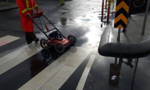
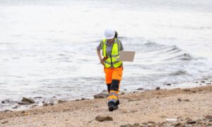
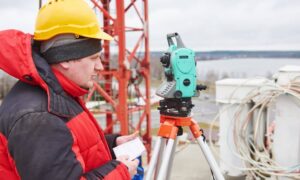
Surveyors came in to map those property lines. Using RTK GPS receivers and aerial drones, they measured the edges of each parcel and matched them to canal coordinates. Their work created the base map used by engineers and cleanup crews. Without it, no one could say for sure whose land was affected or how much shoreline needed to be repaired.
In simple terms, the boundary survey gave the cleanup team a digital map of responsibility. It turned guessing into clear facts.
The Technology Behind the Data

Modern surveying goes far beyond tripods and measuring tapes. In this case, crews used UAV photogrammetry—drones that took thousands of overlapping photos—to build 3D maps of the spill site. They also used hydrographic survey tools, like sonar, to measure what was happening below the water’s surface.
By combining drone photos, GPS data, and sonar readings, surveyors created a complete picture of the canal. These maps helped the Environmental Protection Agency (EPA) and MWRD estimate how much material needed removal, plan safe cleanup routes, and confirm that the work was finished correctly.
Chicago’s underground systems are old and crowded with utilities. Having precise boundary data keeps everyone—engineers, inspectors, and city officials—working from the same information.
Why Boundaries Define Accountability
When contamination crosses a property line, the first question is, “Who’s responsible?” A boundary survey gives a clear answer. It shows exactly where one property ends and another begins.
In this spill, survey data revealed that part of the contaminated canal bank was inside privately owned industrial land. That meant several parties had to share the cleanup costs. The survey also showed where public property started, which helped the city avoid paying for damage it didn’t cause.
A few feet can make a big difference. Those few feet can mean thousands of dollars in cleanup or legal costs. With a certified boundary survey, the coordinates are official—and the results hold up in court or insurance claims.
Accuracy Under Pressure
Environmental emergencies are never easy places to work. Surveyors often gather data while crews are still responding. In this case, they worked through mud, machinery noise, and moving water—yet still kept accuracy within fractions of an inch.
They used calibrated instruments and logged every measurement with time stamps and coordinates. This recordkeeping, called a chain of custody, proves the data is correct if it’s ever reviewed later.
Precision isn’t just about numbers—it’s about fairness. Cleanup budgets depend on accurate measurements of land and water. If a survey is wrong, costs and responsibilities can shift to the wrong people.
From Cleanup to Prevention
Once the first cleanup phase ended, surveyors returned to help with restoration. The same boundary maps were used to check that new barriers and repaired shorelines stayed within the correct limits.
They also updated floodplain and elevation data, which helps Chicago plan for future floods and heavy storms. These updated maps make it easier to prevent future spills and protect nearby neighborhoods.
One boundary survey didn’t just fix a problem—it helped make the system safer for years to come.
What This Means for Property Owners
Most people will never deal with a canal spill, but this story still teaches an important lesson: boundaries matter most after something goes wrong. If your property borders a river, canal, or shared access road, a current boundary survey can protect you from unexpected costs.
Imagine storing materials near a ditch, not realizing that part of it lies outside your lot. If runoff causes damage, you could be blamed. Or picture repairing a wall that extends into a city right-of-way. Without a survey, you might face fines or stop-work orders.
For builders and developers, the message is simple: check your boundaries before starting any project. In Chicago, many sites are near waterways or rail lines. Submitting an updated boundary plat can save weeks of review and prevent major issues later.
The Broader Impact of a Simple Survey
Chicago’s canal system supports shipping, wastewater control, and flood management—all of which rely on accurate maps. The recent spill proved that boundary surveys aren’t just for private property—they help protect public health, safety, and the environment.
By defining exact property lines, surveyors help agencies act faster and make fairer decisions. Their data keeps emergency crews, engineers, and lawyers working from the same plan.
When you see a map of Chicago’s canals or flood zones, remember that those lines exist because surveyors measured them, verified them, and signed off with professional care.
Know Where You Stand
The canal spill may fade from the headlines, but its lesson remains. Boundaries aren’t just lines on paper—they guide every decision when property, safety, and the environment are involved.
If your land is near a waterway or shared area, it’s wise to get a professional boundary survey before starting new work. It’s a small cost that can prevent huge problems later.
In the end, the success of Chicago’s canal cleanup didn’t just rely on heavy equipment—it depended on the data surveyors collected. Their boundary work gave the city the clarity it needed to act quickly, assign responsibility fairly, and protect one of its most important waterways for the future.


