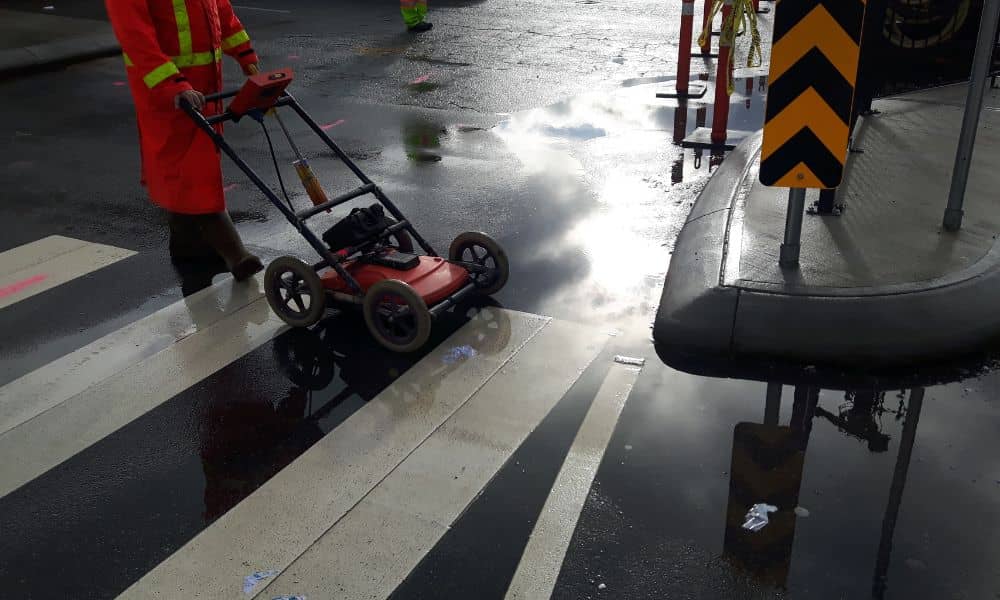
Chicago’s lead pipe crisis keeps making headlines, but most people still miss the real problem hiding under the streets. Everyone talks about the aging water lines and the huge cost of replacing them. However, the part that slows everything down isn’t plumbing. It’s the lack of accurate underground maps. That’s why this issue is turning into a construction survey challenge that affects homeowners, builders, and the entire city.
Chicago has more than 412,000 lead service lines, which is more than any other city in the United States. Yet only around 14,000 have been replaced so far. With federal rules that require full replacement by 2047, the pressure is growing. But workers can’t speed up until they know exactly where every old pipe actually sits. Without clear maps, every dig becomes a guess. And when crews guess, mistakes happen, timelines stretch, and costs jump. Surveying is the missing link, but it rarely gets the attention it deserves.
The Scale of Chicago’s Lead Pipe Problem
The size of the challenge is staggering. Replacing one service line can reach $25,000 to $35,000, depending on location and complexity. Multiply that by hundreds of thousands of homes, and you see why Chicago is facing a multi-billion-dollar project. And since the city replaced only a small fraction in the last few years, it becomes harder to meet the deadline.
Many older neighborhoods add even more problems. Service lines weave under sidewalks, gangways, shared driveways, and tight alley spaces. Some pipes run close to other utilities like gas, sewer, and electric. When records don’t match the reality underground, every job slows down. This is why crews need accurate, updated maps before they can safely dig.
Old Maps Cause New Delays
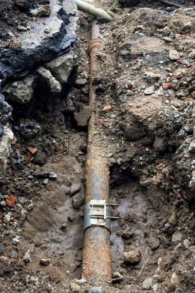
Chicago’s underground records are a mix of old sketches, faded notes, and incomplete information. Many maps date back decades and don’t show the exact depth or location of each pipe. Some lines were installed before modern tools existed. Others were rerouted during past repairs without proper updates.
Because of this, workers waste time locating lines before they can begin real work. They dig small test holes, try different spots, and sometimes hit other utilities by accident. Every wrong move adds delays and costs. And when a pipe sits only a few inches away from another utility, one mistake can shut down an entire street.
This creates stress for homeowners too. Some people see their sidewalks or lawns dug up multiple times because the first try wasn’t accurate. Crews want to do the job right, but they work with bad information. That’s why the city needs precise surveying now more than ever.
Why Construction Surveying Matters
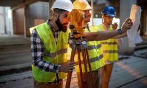
A construction survey solves these problems by giving crews a clear picture of what lies under the ground. Surveyors locate the exact path of the old pipe, mark the depth, and map nearby utilities. They check how close the line sits to the house foundation, garage, sidewalk, or alley. With this information, construction crews dig with confidence instead of guessing.
Surveying also helps reduce last-minute changes. When crews understand the underground conditions ahead of time, they avoid surprise add-on costs. They also avoid damaging private property or nearby utilities. A good survey lets the team finish the job faster, safer, and with fewer headaches for homeowners.
And once the new pipe goes in, surveyors return to measure and record the updated location. They create accurate as-built maps that the city can rely on for future work. Over time, Chicago will build a real digital record of its underground network, something it lacked for decades.
Chicago’s Neighborhood Layout Makes Things Harder
Chicago’s layout adds even more challenges. Many blocks have narrow lots, older garages, tight gangways, and long service lines that cross under different parts of a property. Some pipes run under a neighbor’s yard. Others sit under additions or patios that didn’t exist when the line was first installed.
In many areas, property boundaries and utility routes don’t match modern codes. Soil movement over the years can shift the line slightly. Older homes may have unusual routes that don’t follow the shortest or straightest path. With so many unknowns, crews can’t rely on decades-old drawings. They need fresh, accurate measurements.
A construction survey helps bring order to this chaos. It reveals the exact route, depth, and condition of the line. It also helps identify obstacles that could slow down or block the replacement. This saves time for crews and money for property owners.
How This Crisis Affects Homeowners
Most people see this as a city problem, but the impact hits homeowners directly. When your block gets selected for pipe replacement, crews need access to the pipe on your property. Without knowing where it runs, they might dig in the wrong spot or need multiple holes to locate it.
If you plan to build a garage, an addition, a new driveway, or even a patio, the water line location becomes important. A construction survey helps you avoid clashing with future pipe work. And when you decide to sell your property, buyers and lenders may ask for proof of the pipe’s condition and location. Clear records help avoid questions during closing.
More homeowners are also asking for surveys before renovations. They want to avoid hitting utilities during construction or having to redo their plans later. With accurate information, builders can design safer, smarter projects.
What Surveyors Do That Contractors Cannot
Contractors replace the pipe, but surveyors prepare the path. Surveyors measure the land, locate utilities, and mark the exact points where digging should happen. They help workers avoid mistakes and finish the job smoothly. Their measurements become the official record the city uses for future repairs or improvements.
Without this work, Chicago cannot move faster. The city depends on clear, up-to-date maps to avoid wasted time and money. Surveyors give homeowners something just as important: peace of mind.
The Path Forward for Chicago
Chicago cannot replace more than 400,000 lead pipes without fixing the way it collects and updates underground information. As construction survey teams map the city’s pipes correctly, the replacement process becomes safer, cheaper, and faster. Surveying connects the old records with new data and helps protect both the property and the people living on it.
While the headline focus is on water safety, the truth is simple: Chicago doesn’t just need new pipes. It needs better maps.
And that work begins with a construction survey.
