LiDAR Mapping Accuracy: What Developers Must Know
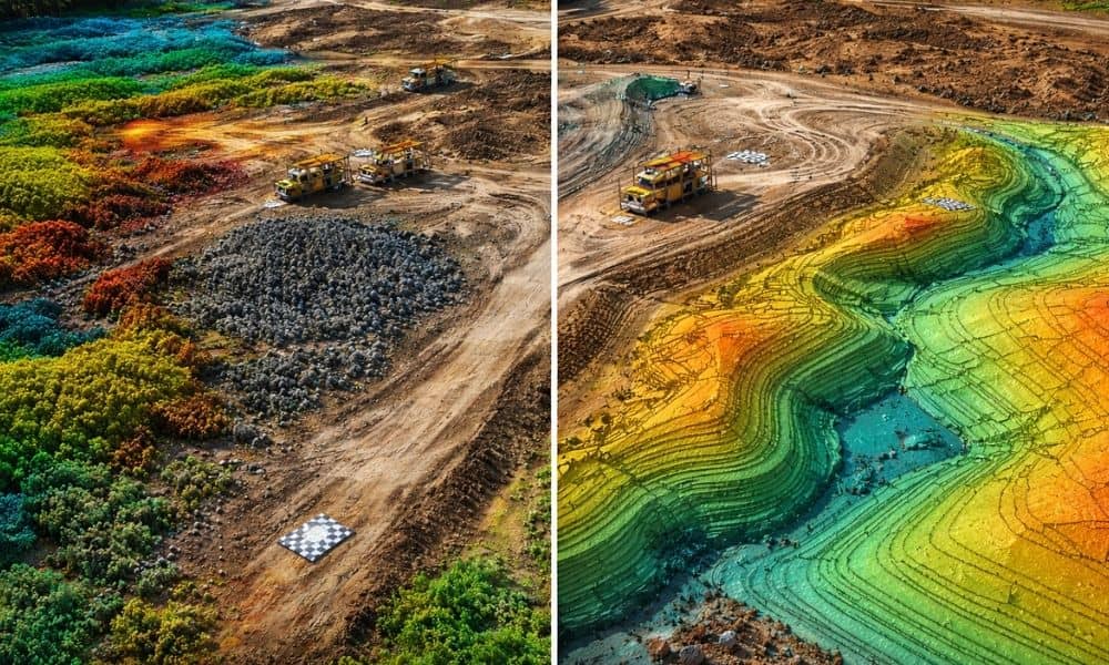
LiDAR mapping has become a go-to tool for site development in Chicago. Developers use it to get fast surface data, review elevation changes, and move projects forward with confidence. However, there is one part of LiDAR mapping that many clients never hear about. That part is called data registration. You can fly the best drone […]