
How 6 Inches Can Flood Your Home | Elevation Survey
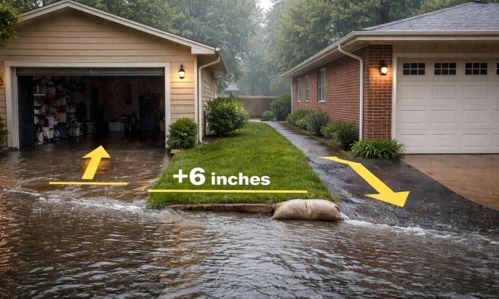
Last week, heavy rain poured over parts of Chicago. Streets filled fast. Cars stalled. Basements took on water. On one block, two houses sat side by side. One flooded. The other stayed dry. What made the difference? About six inches. That small change in height can decide where water goes. And the only way to […]
The Risk of Using an Outdated Topographic Survey

Chicago never stands still. New towers rise. Old warehouses turn into lofts. Streets get milled and repaved. Utilities get replaced block by block. At first glance, the city may look the same year after year. However, beneath the surface, small shifts happen all the time. Engineers and planners now recognize a quiet reality: parts of […]
Drone Surveying in Dense Tree Cover: Better Accuracy
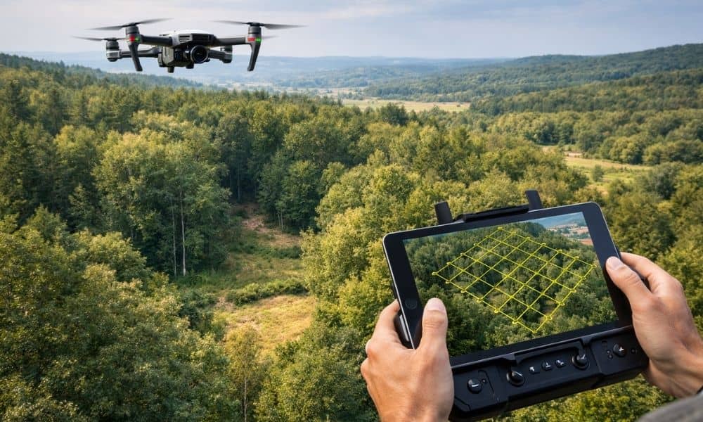
Drone surveying works great on open land. However, wooded sites around Chicago tell a different story. Trees block the ground, shadows hide details, and leaves confuse mapping software. As a result, many property owners get terrain models that look clean but miss real ground conditions. So if you plan a home build, subdivision, driveway layout, […]