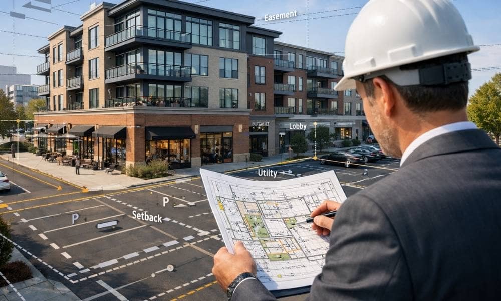
Buying a mixed-use building isn’t like buying a house. You’re not just checking one roof and one lot line. You’re checking a building that might have a coffee shop on the ground floor, apartments above it, and maybe an office tucked in the back. Each of those spaces comes with its own rules, its own tenants, and its own way of causing trouble if nobody looks closely enough before closing.
An alta land survey is the tool that looks closely. It’s built for exactly this kind of complexity. Here’s why it matters more than most buyers realize, especially right now.
Chicago’s Mixed-Use Zoning Expansion Is Changing What Buyers Need to Verify
Chicago has been rezoning corridors for years now, opening up streets that used to be strictly residential or strictly commercial. Transit-oriented development rules have pushed more mixed-use buildings into neighborhoods that never had them before.
That’s good for density. It’s good for walkability. But it creates a quiet problem for buyers.
A building’s zoning designation on paper can drift away from what’s actually built on the ground. A property might be zoned for mixed use today, but the physical structure could still reflect an older layout from before the corridor was rezoned. Maybe a wall was never updated. Maybe an entrance was added without proper approval.
An alta land survey checks the physical reality against the legal designation. It doesn’t assume the two match just because a zoning map says so.
Stacked Uses Create Boundary Questions a Standard Survey Won’t Catch
A single-use building has one owner, one purpose, one simple footprint. A mixed-use building is different. Retail sits on one floor. Residential or office space sits above it. Sometimes different owners hold different floors entirely.
That stacking creates boundary questions that a basic survey isn’t built to answer. Where exactly does one owner’s space end and others begin, especially above ground level? Are there air rights conflicts between floors? Does a vertical wall on floor two actually line up with the wall below it on floor one?
These aren’t hypothetical. Older buildings that were converted from single-use to mixed-use often have small structural mismatches between floors. An alta land survey is detailed enough to catch these before they become expensive arguments between owners.
Parking Ratio and Loading Zone Compliance for Mixed Tenant Types
Mixed-use buildings have to serve more than one kind of tenant. Retail customers need parking. Residential tenants need parking too, usually a different amount. Delivery trucks need a loading zone that doesn’t block either group.
Zoning codes set specific ratios for each use. A building that was originally built for one purpose and later converted often falls short of what current mixed-use rules require.
A survey documents what actually exists on site. It maps striped parking spaces, drive aisles, and loading areas exactly as they sit today. That documentation gets compared against the zoning requirements for the building’s combined uses. If there’s a shortfall, you want to know before you own the problem, not after.
Verifying Party Walls and Shared Structural Elements Between Mixed-Use Neighbors
Dense corridors mean tight lots. Tight lots mean buildings that share walls, and sometimes share foundations, with the building next door.
That gets complicated fast when the neighboring building serves a completely different purpose. A retail building sharing a wall with a residential structure raises questions that a simple lot survey won’t answer. Who’s responsible for maintaining that wall? Is there an existing agreement covering it? Has anything physically encroached across the property line over the years?
An alta land survey documents party walls and shared structural elements directly. It records what’s already agreed to, and it flags anything that looks like it’s crossed the line, literally, without permission.
Utility and Easement Conflicts From Multiple Building Systems
A mixed-use building usually runs more utility lines than a single-use one. Retail needs its own meter. Residential units need theirs. Office space might need something different again.
Over time, as a building’s use expanded, these systems often got added piecemeal. A line gets run through a space it technically shouldn’t cross. A meter gets installed without anyone updating the easement records.
A survey maps these systems as they actually exist. It flags conflicts between utility lines and recorded easements, especially in older buildings where upgrades happened in stages rather than all at once. Catching these issues early saves a buyer from inheriting a utility dispute they didn’t know existed.