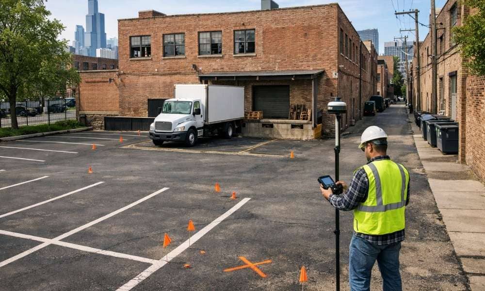
Chicago is full of buildings that change hands. An old warehouse turns into a brewery. A retail strip turns into offices. A vacant lot turns into new housing.
Every one of these projects hits the same three questions early on. Is there enough parking? Is there a real loading spot? Who owns that alley behind the building?
Survey mapping answers these questions with facts. No guesses. For developers working through Chicago’s redevelopment process, that matters a lot. City staff, architects, and lenders all want proof of site conditions before they approve anything. Survey mapping gives them that proof.
Here is how it helps with the parts of a project that trip up developers most.
Mapping Existing Parking Counts Against Chicago’s Off-Street Parking Rules
Before you plan new parking, you need to know what is already there. Survey mapping records every striped stall on a site. It records drive aisles too. It captures exact sizes, not rough guesses.
That count becomes your starting point. You compare it to Chicago’s off-street parking rules for your new use. If a building shifts from light industrial to retail, the parking rules can change. Mapped data shows you the gap right away. You see it before you get deep into design work.
This step also catches problems early. Sometimes old stalls do not meet today’s size rules. Sometimes drive aisles are too narrow for two-way traffic. A survey shows these issues before a city reviewer does.
Locating Loading Berths for Adaptive Reuse and Change-of-Use Permits
Turning a warehouse into something new almost always raises the loading question. Chicago’s rules link loading needs to the type of use. A building that never needed a loading spot as a warehouse might need one as a store or restaurant.
Survey mapping records what is already on site. This means berth size, roof clearance, and how trucks get in and out. This is the first thing permit reviewers ask for.
If your site has a loading dock but it is too small or in the wrong spot, mapped sizes let your architect plan around it. You find out early, not in the middle of a permit review. That saves time and stops your project from stalling.
Identifying Alley Dedications, Vacations, and Right-of-Way Lines
Chicago’s older business areas have alleys with messy histories. Some are still public land. Others were closed years ago and given back to nearby owners. Some look public but are actually private.
This matters a lot for your project. If you plan to use, gate, or build near an alley, you need to know who controls it.
Survey mapping checks old plats and city records to sort this out. It shows the true property line, not just where the pavement sits. In older blocks, the pavement often does not match the recorded line. That gap can cause real legal trouble if it gets missed.
Flagging Encroachments Into Alleys From Docks, Dumpsters, and Additions
Buildings shift into their surroundings over time. Not always the legal way. Loading docks, roofs, trash bins, and old additions often creep past the property line and into the alley.
Survey mapping finds these problems. It compares what is really on site to the recorded property lines. This matters because a problem found late can stall your permit. The city or a neighbor can force you to move or remove the item. That costs time and money you did not plan for.
Finding this during the survey stage gives you options. You can design around it. You can work out a deal with the neighbor. You can plan the cost into your budget instead of getting a bad surprise later.
Using Survey Mapping to Plan Truck and Vehicle Circulation for Site Plans
Once you know your parking count, your loading spot, and your alley lines, the next step is traffic flow. Architects and engineers need clear, measured survey data to plan how trucks and cars will move.
This is not a guess. A delivery truck needs a set amount of space to turn without hitting a wall or another dock. The width of the alley decides if two-way traffic will work, or if the city will require one-way flow only. Survey mapping gives engineers real numbers to test these plans before anyone builds anything. Not after a truck gets stuck.
City reviewers rely on this data too. They want proof that traffic will actually work on the ground. Not just look good on paper.
FAQ
Does survey mapping show if an alley is city-owned or privately owned?
Yes. Survey mapping checks old plats and city records. It shows if an alley is public land, a closed alley now owned by nearby owners, or a private easement. This decides who can legally use or block it.
Can survey mapping help settle a fight over a shared loading dock?
Yes. Survey mapping can show exactly where a shared dock sits compared to the recorded property lines or lease areas. This gives property managers real facts to settle access disputes.
Why does a change-of-use permit in Chicago sometimes need new parking or loading counts, even without construction?
Chicago’s rules link parking and loading needs to the type of use, not just the building shape. A shift from office to retail can trigger new rules even if nothing gets built.
How does survey mapping handle odd or angled alleys in older blocks?
Survey mapping checks the real alley in the field. It measures the true width, angle, and paved edges instead of trusting old plats. This matters in older areas where alleys were built before today’s rules.
Is survey mapping for parking and loading review different from a normal boundary survey?
Yes. It focuses on site features like pavement, striping, and access points that affect code approval and site plans. A normal boundary survey mainly sets property lines and corners.